
Terrain and bathymetry#
Terrain adds ground elevation. Bathymetry adds positive water depth and keeps
turbine bases at zero height. Neither moves turbines horizontally, and both are
synthetic rather than models of real ground. A SurfaceModel passed to
Sampler(..., surface=...) is generated over the boundary bounds.
import tempfile
from pathlib import Path

import matplotlib.pyplot as plt
import numpy as np

import oowl
from oowl import boundaries as B
from oowl import layouts as L
from oowl import surfaces as SF
Surface models#
GaussianTerrain and GaussianBathymetry add a zero-mean Gaussian field to a
mean plane with a regional gradient. The field has pointwise scale
standard_deviation and squared-exponential covariance
\(\exp\!\left(-d^2/2\ell^2\right)\) with \(\ell\) the correlation_length. It is
drawn on an internal grid of spacing \(\ell/8\), so resolution does not change
the realization, and it is never rescaled or clipped. The grid is drawn by
circulant embedding with the FFT, after Dietrich and Newsam,
“Fast and exact simulation of stationary Gaussian processes through circulant
embedding of the covariance matrix”,
SIAM Journal on Scientific Computing 18 (1997), 1088-1107. It is padded by
\(8\ell\), so its covariance is exact to about \(10^{-14}\), and a domain of any
size within the surface allocation budget takes a fraction of a second.
PerlinTerrain and PerlinBathymetry blend random unit gradients on a square
lattice of cell size correlation_length with the fade
\(f(t)=6t^5-15t^4+10t^3\) of Perlin,
“Improving noise”,
ACM Transactions on Graphics 21 (2002), 681-682. Corner dot products are
bounded by \(\sqrt2\) and the blend is convex, so noise \(n\) maps into the range by
The range is a bound, not the attained extrema. Equal correlation_length
values give different feature sizes in the two models.
boundary = B.OffshorePolygon(area=8_000_000, seed=7)
models = {
    "GaussianTerrain": SF.GaussianTerrain(
        mean=100.0, standard_deviation=20.0, gradient=(0.001, 0.0), seed=7
    ),
    "GaussianBathymetry": SF.GaussianBathymetry(
        mean=50.0, standard_deviation=5.0, seed=8
    ),
    "PerlinTerrain": SF.PerlinTerrain(elevation_range=(20, 180), seed=7),
    "PerlinBathymetry": SF.PerlinBathymetry(
        depth_range=(15, 55), correlation_length=1_500, seed=8
    ),
}
farms = {
    name: oowl.Sampler(boundary, L.Grid(24, seed=3), surface=model).sample()[0]
    for name, model in models.items()
}
fig, axes = plt.subplots(2, 2, figsize=(11, 10))
for ax, (name, farm) in zip(axes.flat, farms.items()):
    farm.surface.plot(ax=ax, title=name)
    farm.plot(ax=ax, facecolor="none", edgecolor="C1", alpha=1.0, color="C1")
fig.tight_layout()
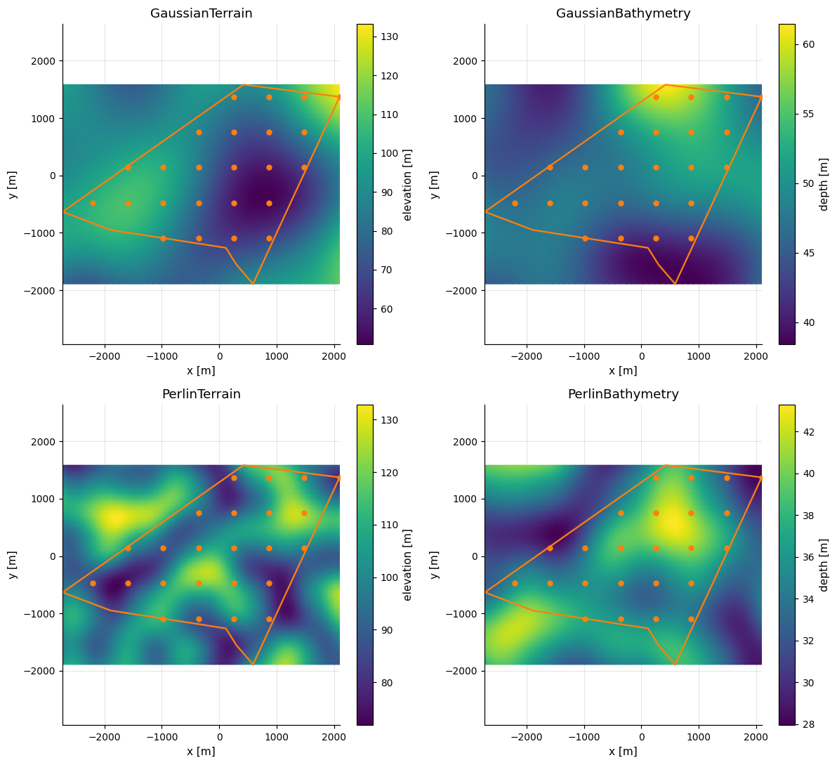
Terrain sets the turbine base z to the ground elevation. Bathymetry keeps it
at zero, and surface.at(points) interpolates the depth bilinearly anywhere
in the grid.
print("terrain [x, y, z]:", np.round(farms["GaussianTerrain"].coordinates[:2], 1))
offshore = farms["GaussianBathymetry"]
print("bathymetry base z:", offshore.coordinates[:2, 2])
print("water depth [m]:", np.round(offshore.surface.at(offshore.positions[:2]), 1))
terrain [x, y, z]: [[ -977.2 -1090.6    90.3]
 [ -361.8 -1090.6    72.3]]
bathymetry base z: [0. 0.]
water depth [m]: [45.6 41.8]
Sign rules#
Terrain is signed elevation, so negative values are basins. Bathymetry
requires positive depth at every node, whether generated, built by hand or
loaded. PerlinBathymetry rejects a depth_range touching or crossing zero,
and GaussianBathymetry raises if a generated depth is not positive.
values = np.full((3, 3), 25.0)
values[1, 1] = -2.0
attempts = {
    "Terrain with a -2 m node": lambda: SF.Terrain([0, 1, 2], [0, 1, 2], values),
    "Bathymetry with a -2 m node": lambda: SF.Bathymetry([0, 1, 2], [0, 1, 2], values),
    "PerlinTerrain((-5, 40))": lambda: SF.PerlinTerrain(elevation_range=(-5, 40)),
    "PerlinBathymetry((0, 40))": lambda: SF.PerlinBathymetry(depth_range=(0, 40)),
}
for label, attempt in attempts.items():
    try:
        attempt()
        print(f"{label:30s} accepted")
    except ValueError as error:
        print(f"{label:30s} ValueError: {error}")
Terrain with a -2 m node       accepted
Bathymetry with a -2 m node    ValueError: bathymetry depths must be positive
PerlinTerrain((-5, 40))        accepted
PerlinBathymetry((0, 40))      ValueError: depth_range must contain only positive depths
Resolution#
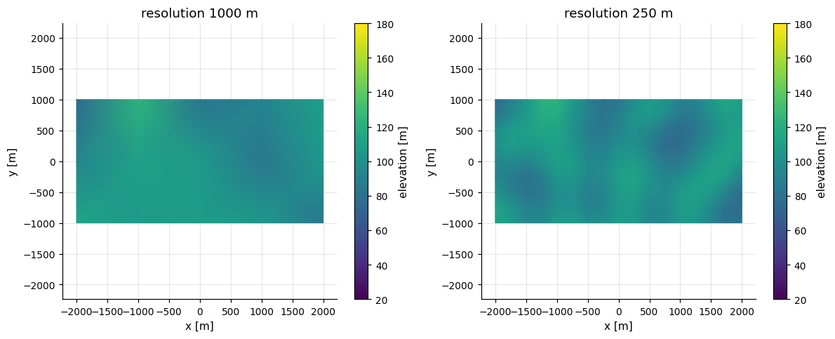
Grids of different resolution agree exactly at shared nodes for the same
boundary and seed. Coarse grids lose detail, so check convergence when slopes
or heights matter.
rectangle = B.Rectangle(4, 2, area=8_000_000)
fig, axes = plt.subplots(1, 2, figsize=(11, 4.5))
surfaces = []
for ax, resolution in zip(axes, [1_000, 250]):
    surface = SF.PerlinTerrain(
        elevation_range=(20, 180), resolution=resolution, seed=7
    ).generate(rectangle)
    surfaces.append(surface)
    surface.plot(ax=ax, title=f"resolution {resolution:g} m")
    ax.collections[0].set_clim(20, 180)
fig.tight_layout()
difference = np.max(np.abs(surfaces[0].values - surfaces[1].values[::4, ::4]))
print(f"largest shared-node difference: {difference:.3g} m")
largest shared-node difference: 0 m
Saving and loading#
Bathymetry is saved to windIO’s site.bathymetry as points with their
depth, which the windIO site schema
accepts, or as a NetCDF grid with surface_format="netcdf", which windIO loads
but its schema does not accept.
Terrain uses site.elevation and turbine z. Elevation is only a permissive
future windIO field, so other consumers may not read it.
with tempfile.TemporaryDirectory() as directory:
    loaded = oowl.load(offshore.save(Path(directory) / "offshore.yaml"))
print(type(loaded.surface).__name__, loaded.surface.values.shape)
print("depths preserved:", np.allclose(loaded.surface.values, offshore.surface.values))
Bathymetry (36, 50)
depths preserved: True